Explore the Best Bukit Gasing Hiking Trails Map in 1-Day
Bukit Gasing is a beautiful forest reserve located between Kuala Lumpur and Petaling Jaya. It offers a variety of trails for hikers of all skill levels. You can find many routes on a Bukit Gasing hiking trails map. This guide helps you plan a perfect nature escape in the city.
Many locals come here to escape the busy city life every weekend. The park features lush greenery and diverse wildlife for visitors to enjoy. It is one of the best free nature spots in Kuala Lumpur today. You will find peace and quiet among the tall tropical trees.
Planning your route is important because the paths can be quite steep. A good map ensures you do not get lost in the jungle. This itinerary covers everything you need for a successful one-day adventure. Get ready to explore the hidden gems of this urban forest.
1-Day Bukit Gasing Hiking At a Glance
Learn more at Kuala Lumpur International Airport (KLIA).
For practical details and last-minute changes, use Rapid KL (Prasarana Malaysia).
This quick overview helps you visualize your day in the forest. We have selected the most popular paths for your first visit. The schedule focuses on seeing the main highlights efficiently. You will experience the best of the local nature scene.The morning starts with the most famous landmarks in the park. You will have plenty of time for photos and short breaks. The afternoon allows for a more relaxed pace through the trees. Finish your day with some delicious local food nearby.
Make sure to check the weather forecast before you head out. Rain can make the trails slippery and harder to navigate. Early starts are always better to avoid the midday heat. This plan is perfect for a weekend morning adventure.
- Day 1: Explore the lush forest trails of Bukit Gasing.
- Morning: Hike the suspension bridge trail.
- Afternoon: Visit the watchtower for city views.
- Evening: Enjoy local food in nearby Petaling Jaya.
Detailed 1-Day Bukit Gasing Hiking Trails Map Itinerary
Your journey begins at the main entrance on the Petaling Jaya side. This area has the most clear trail markers for new hikers. Follow the Bukit Gasing hiking trails map toward the suspension bridge. This path offers a moderate challenge for most fitness levels.
After the bridge, continue toward the wooden watchtower for a view. You can see the Kuala Lumpur skyline from certain vantage points. Take your time to appreciate the sounds of the jungle birds. The forest provides a cool canopy even on sunny days.
The loop trail usually takes about three hours to complete fully. You can adjust your speed based on how you feel. There are several benches along the way for resting. Always stay on the marked paths to protect the environment.
- Day 1: Master the Bukit Gasing forest loop.
- Morning: Start early to avoid heat.
- Afternoon: Explore the watchtower trails.
- Evening: Relax at a nearby cafe.
- Time: Four to six hours.
- Logistics: Use the main park entrance.
- Optional: Visit the nearby temple.
Navigating the Bukit Gasing Hiking Trails Map
Using a Bukit Gasing hiking trails map is essential for new visitors. The forest has many intersecting paths that can be confusing. You should download a digital version before you start your hike. This ensures you stay on the correct path throughout the day.
There are two main entrances to the forest reserve. Most hikers prefer the Petaling Jaya side for its facilities. You can find clear signage at the start of most trails. These signs help you choose the right difficulty level.
Check the best time for Bukit Gasing hiking before you leave. The trails are busiest during the early morning on weekends. Weekdays offer a much quieter experience for nature lovers. You will have more space to enjoy the scenery alone.
Where to Stay Near Bukit Gasing
Finding a good base makes your hiking trip much easier. Petaling Jaya is the most convenient area for this specific park. You can find many affordable hotels and guesthouses in this district. It is only a short drive to the park entrance.
Bangsar is another great option for travelers who love food. This neighborhood has a trendy vibe and many local cafes. It is well-connected to the rest of Kuala Lumpur by train. You can reach the forest trails in about fifteen minutes.
Staying near a metro station helps you avoid city traffic. The Kerinchi station is quite close to the northern park entrance. Many visitors choose this area for its modern amenities. You will find plenty of shopping and dining options here.
Essential Gear for Kuala Lumpur Trails
⭐ Recommendation: Don't miss out on amazing Kuala Lumpur tours - book now!
The tropical climate requires some specific gear for your hike. Good hiking shoes with grip are the most important item. The ground can be muddy and slippery after a light rain. Proper footwear will prevent injuries on the steeper sections.
Always carry at least one liter of water with you. The humidity in Malaysia makes you sweat more than usual. Staying hydrated is key to enjoying your time in nature. You might also want to bring a light snack.
Insect repellent is highly recommended for any jungle trek. Mosquitoes are common in the shaded areas of the forest. Wearing long pants can also help protect your skin. A small towel is useful for wiping away sweat.
Nearby Free Nature Spots in Kuala Lumpur
Kuala Lumpur has many other green spaces to explore. Visit the KLCC Park free activities guide for more ideas. This park offers great views of the Petronas Twin Towers. It is a perfect spot for a relaxing evening walk.
Consider walking through the Perdana Botanical Gardens as well. This massive park features a lake and many exotic plants. It is located right in the heart of the city center. You can spend several hours wandering through the different sections.
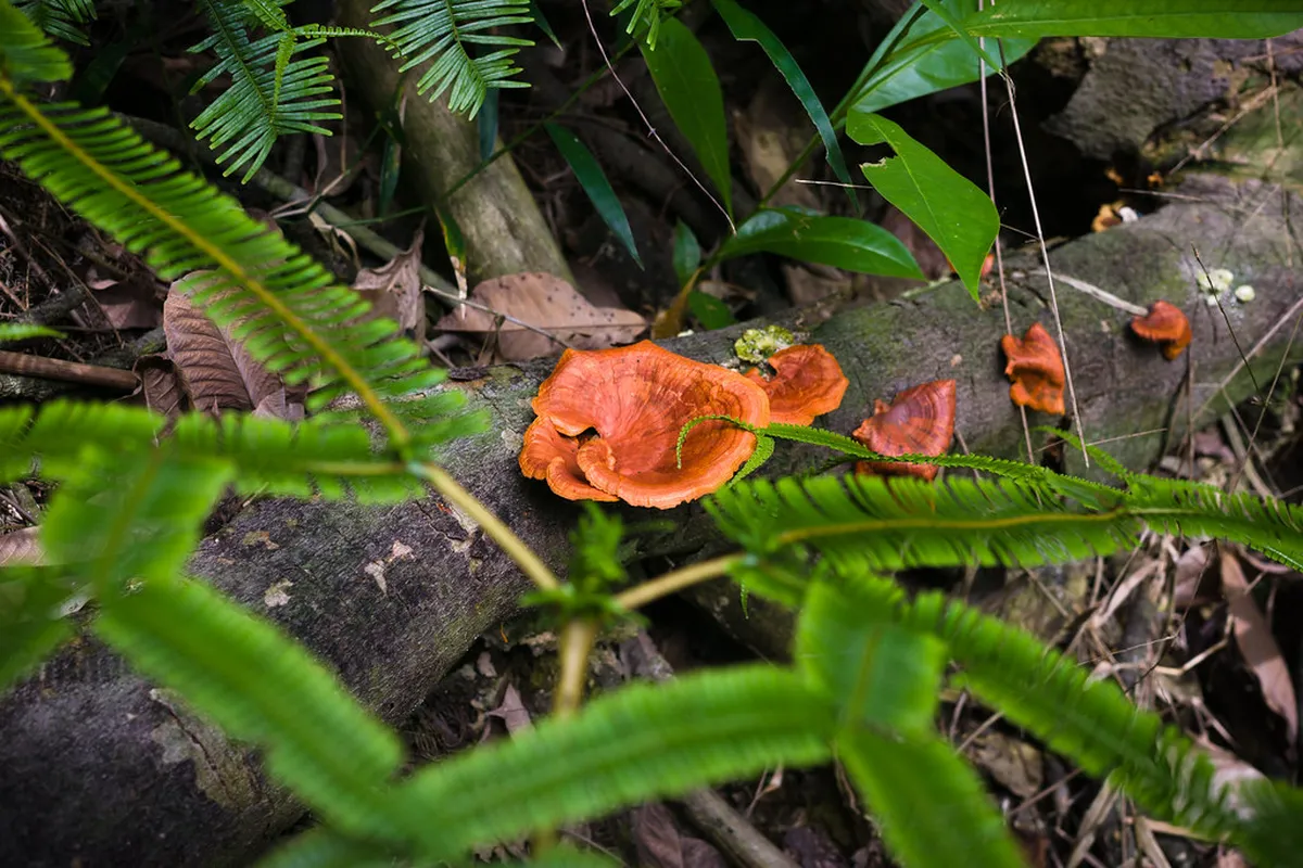
This park is one of the free nature photography spots in KL. You can capture beautiful images of the local flora and fauna. The lighting is best during the early morning or late afternoon. Bring your camera to document your Malaysian nature journey.
Frequently Asked Questions
Is Bukit Gasing free to enter?
Yes, there is no entrance fee for this forest reserve. It is one of the best free nature spots in the city. You can enjoy the trails without spending any money.
How long does it take to hike Bukit Gasing?
A typical hike takes about two to three hours. This depends on your fitness level and the route chosen. Most visitors spend a half day exploring the forest.
Is Bukit Gasing suitable for beginners?
The trails offer various difficulty levels for all hikers. Beginners should stick to the main paths near the entrance. Always bring plenty of water for the humid weather.
Bukit Gasing is a fantastic destination for anyone visiting Kuala Lumpur. Using a Bukit Gasing hiking trails map makes the experience much better. You can enjoy the fresh air and beautiful jungle scenery easily. It is a perfect break from the busy city streets.
We hope this 1-day itinerary helps you plan your next hike. Remember to respect the environment and stay on the trails. Enjoy your adventure in this wonderful Malaysian forest reserve. Safe travels on your journey through the green heart of KL.